HomeWriting
The maps below show the changes that occurred to a town named Willington in 1780, 1860
2024-08-02
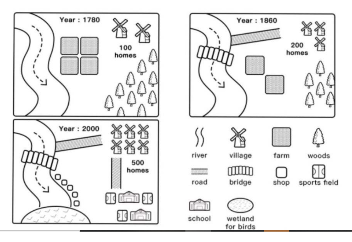
The map delineates the evolution of Willington from 1780 to 2000.
As years passed from 1780 to 2000 along with the establishment of new amenities, including shops, schools and roads, the town welcomed more residents/the town became more residential and commercial. Notably, while farms and woods vanished/were removed, the river remained unaltered throughout the surveyed period.
In 1780, the town boasted four farms along the riverbank, accompanied by a total of 100 homes. The southeastern part of the town was densely covered with woods. However, in 1860, farms underwent/experienced a transformation/shift/conversion, assuming the construction of a road leading from the river to a residential area that had doubled in size (200 homes) in the northeast
By 2000, a considerable transformation had taken place with the introduction of various facilities aimed at enhancing the residents' quality of life. The number of villages and homes witnessed a notable surge. The landscape saw a complete disappearance of farms and woods, making way for the construction of essential amenities such as schools, sports fields, and shops. A wetland for birds emerged in the southern part of the map, providing a distinct ecological feature.